The Safest Neighborhoods in San Francisco: A Homebuyer's Guide | Philip Farr Properties
June 1, 2026
When choosing where to live in San Francisco, safety ranks among the top considerations for most homebuyers. While the city has seen significant improvements in recent years, safety levels can vary dramatically by neighborhood.
This guide identifies San Francisco's five safest neighborhoods based on 2026 crime data from the SF Chronicle and SFPD [1], combining both violent and property crime statistics for a complete safety picture. Beyond the numbers, each neighborhood offers distinct lifestyle advantages, architectural character, and community dynamics that appeal to different types of buyers.
What's covered:
- The top 5 safest San Francisco neighborhoods by total crime rates (violent + property)
- Median home prices, walkability scores, and neighborhood character
- Spin-off rankings for lowest violent crime and lowest property crime
- Citywide safety trends and what they mean for homebuyers
- How to balance safety with other homebuying priorities
San Francisco's Safest Neighborhoods: 2026 Overview
These five neighborhoods consistently rank among San Francisco's safest based on annual crime data from the SF Chronicle's neighborhood analysis [1]. Total crime rates in these areas range from 13.5 to 15.7 incidents per 1,000 residents, compared to citywide hotspots that exceed 90 per 1,000. Beyond low crime, each offers distinct character, walkability levels, and community strengths.
Crime data from SF Chronicle 2025 neighborhood crime analysis [1]. Median home prices from Redfin (Feb-March 2026) [2]. Walk Scores from WalkScore.com and Redfin neighborhood data [3].
*Twin Peaks Walk Score is approximate based on available data for the hillside residential area; walkability varies significantly by specific block due to steep terrain.
The Top 5 Safest San Francisco Neighborhoods
1. Sunset/Parkside: Laid-Back Residential Charm
The Sunset and Parkside neighborhoods share San Francisco's lowest total crime rate at 13.5 incidents per 1,000 residents. This southwestern stretch of the city benefits from its geographic position bordering Golden Gate Park to the north and the Pacific Ocean to the west. The area's predominantly residential character features uniform rows of single-family homes built in the early-to-mid 20th century, many with distinctive pastel facades and classic San Francisco architectural details.
The neighborhoods attract families and professionals seeking a quieter urban experience. Golden Gate Park provides immediate access to trails, gardens, and cultural institutions, while Ocean Beach offers coastal recreation within walking distance. The microclimate brings frequent fog, creating cooler temperatures compared to eastern neighborhoods. Judah Street and Irving Street serve as commercial corridors with grocery stores, cafes, and neighborhood services that support daily life without requiring a car.
At a Glance:
- Median home price: $1.9M [2]
- Walk Score: 83 (Very Walkable) [3]
- Trade-offs: Frequent fog and cooler temperatures, 35-45 min commute to Financial District, limited evening dining/entertainment options
2. Outer Richmond: Ocean-Meets-Urban Balance
Stretching from Arguello Boulevard to the Pacific Ocean, the Outer Richmond claims San Francisco's second-lowest total crime rate at 13.6 incidents per 1,000 residents. The neighborhood's safety stems in part from its geographic position (bordered by the ocean, Lincoln Park, and the Presidio) and strong residential character. Tree-lined avenues of single-family homes and modest apartment buildings create a tight-knit community where neighbors know each other and owner-occupancy rates run high.
Beyond safety, the Outer Richmond offers immediate access to Ocean Beach, Lands End trails, and Golden Gate Park's western edge. The area's cultural diversity shows in its restaurants: dim sum specialists line Clement Street alongside Russian bakeries, Irish pubs, and pan-Asian markets. The microclimate brings more fog than sun, but residents appreciate the neighborhood's balance of urban amenities and natural landscapes. The area attracts families, outdoor enthusiasts, and buyers seeking relative affordability without sacrificing walkability.
At a Glance:
- Median home price: $1.9M [2]
- Walk Score: 89 (Very Walkable) [3]
- Trade-offs: Cooler/foggier microclimate, 30-40 min commute to Financial District, limited nightlife
3. Inner Sunset: Golden Gate Park's Backyard
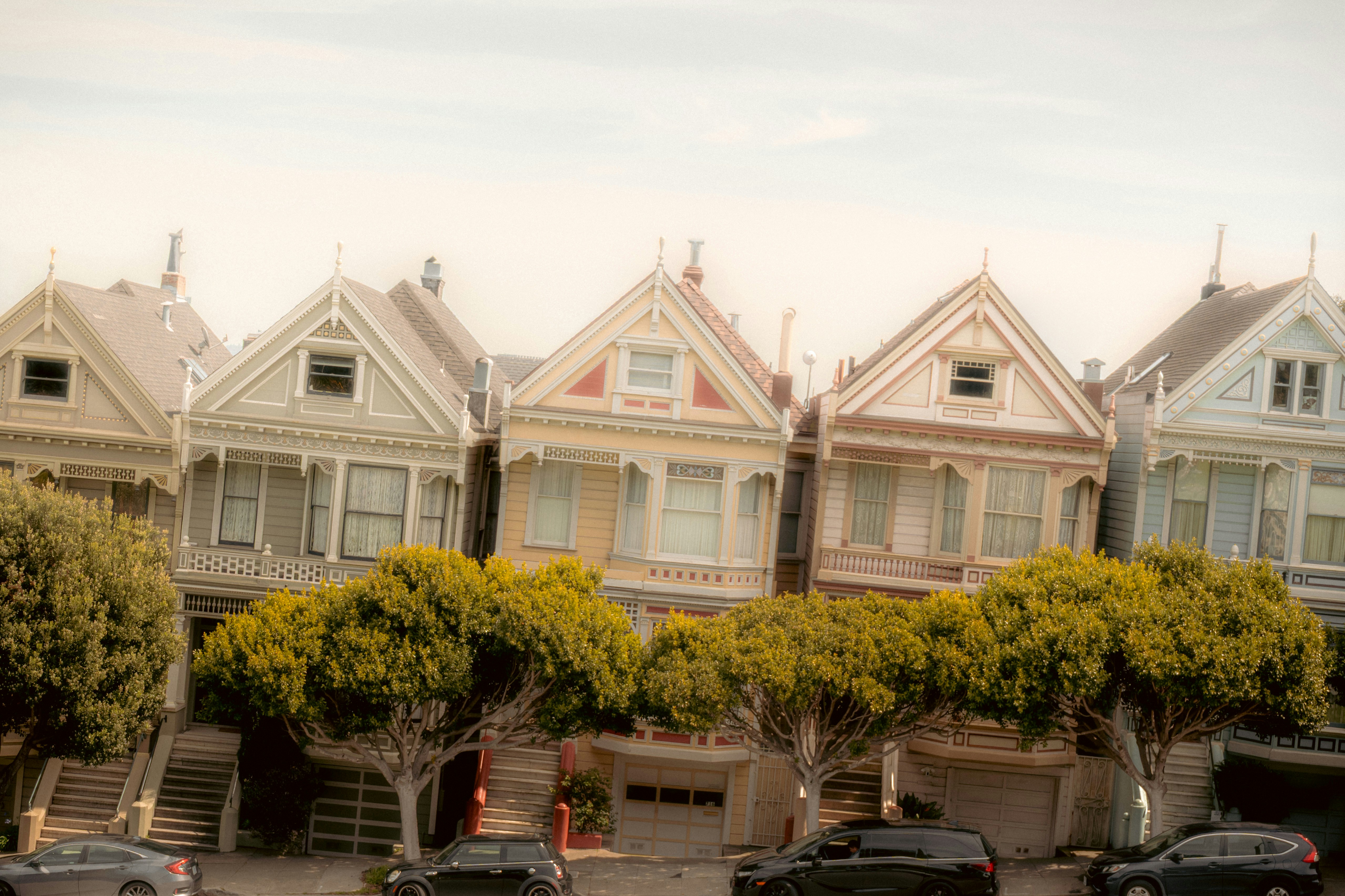
The Inner Sunset ranks third among San Francisco's safest neighborhoods with 14.4 total crimes per 1,000 residents. Positioned between Golden Gate Park and the hills leading to Twin Peaks, the neighborhood functions as a residential enclave with strong community bonds. Victorian and Edwardian homes dominate the tree-lined blocks, many renovated to blend period details with modern interiors. Irving Street serves as the commercial heart, offering coffee shops, bookstores, grocery stores, and restaurants within a compact, walkable corridor.
Golden Gate Park's proximity defines the neighborhood's character. Residents use the park as an extension of their living space for running, picnicking, and cultural outings to institutions like the de Young Museum and California Academy of Sciences. The area's 96 Walk Score reflects exceptional walkability for daily errands, though the microclimate brings afternoon fog that burns off later than eastern neighborhoods. The Inner Sunset attracts professionals, young families, and academics drawn to the University of San Francisco Medical Center nearby.
At a Glance:
- Median home price: $2.2M [2]
- Walk Score: 96 (Walker's Paradise) [3]
- Trade-offs: Afternoon fog, limited street parking, steeper home prices than western neighborhoods
4. Twin Peaks: Elevated Tranquility
Twin Peaks records 15.1 total crimes per 1,000 residents, reflecting its geographic isolation: steep hills create natural boundaries that limit through-traffic and establish clear neighborhood edges. Mid-century modern homes and contemporary residences cling to hillsides, many with panoramic views spanning from downtown to the Golden Gate Bridge.
The neighborhood's character prioritizes privacy and natural surroundings over urban density. Residents accept trade-offs in walkability in exchange for expansive views, larger lots, and separation from city noise. Winding streets like Clarendon Avenue and Portola Drive connect to flatter neighborhoods below, where commercial services cluster. Twin Peaks attracts buyers who value seclusion within city limits: established professionals, empty nesters, and design enthusiasts willing to drive for groceries in exchange for architectural distinction and dramatic vistas.
At a Glance:
- Median home price: $2.25M [2]
- Walk Score: ~70 (Somewhat Walkable, varies by block) [3]
- Trade-offs: Car-dependent for most errands, steep streets challenging for mobility, isolated from dining/nightlife
5. Sea Cliff: Coastal Elegance and Privacy
Sea Cliff claims the lowest violent crime rate in San Francisco at 0.4 incidents per 1,000 residents, with a total crime rate of 15.7. The neighborhood's safety stems from its geographic isolation: bordered by the Pacific Ocean, Lincoln Park, and the Presidio golf course, with only one main entrance via 25th Avenue. This creates a nearly gated-community effect without actual gates. Mediterranean Revival and Spanish Colonial homes line quiet streets that dead-end at coastal trails and China Beach.
The neighborhood represents one of San Francisco's most exclusive addresses. Homes rarely come to market; when they do, architectural significance and ocean views command premium prices. The area attracts established professionals, international buyers, and families seeking maximum privacy within city limits. Trade-offs include limited walkable retail (most residents drive to nearby neighborhoods for dining and services), a cooler coastal microclimate, and high entry costs that restrict inventory turnover.
At a Glance:
- Median home price: $3.9M [2]
- Walk Score: 81 (Very Walkable) [3]
- Trade-offs: High price point, limited dining/retail within neighborhood, cool/foggy microclimate, very limited inventory
San Francisco's 2026 Safety Trends
Understanding neighborhood-specific safety requires context about citywide improvements and persistent challenges. San Francisco has made significant progress across most crime categories in recent years.
Citywide Progress:
Overall crime has dropped 30% from 2024 peaks [4]. Homicides reached a 70-year low, down 45% since 2019 [5]. Motor vehicle theft declined 45%, and larceny fell 27% in the first half of 2025 [5]. Property crimes across most categories now sit at multi-decade lows. These improvements reflect increased police presence in commercial districts, expanded street lighting, and community safety initiatives that have gained traction in residential neighborhoods.
Ongoing Challenges:
Despite broad improvements, certain crime categories remain elevated compared to pre-2019 levels. Gun assaults increased 12% compared to 2019, though they have declined from 2024 peaks [5]. Shoplifting in commercial districts rose 20%, concentrated primarily in Union Square and downtown corridors [5]. Drug-related offenses remain concentrated in specific areas, particularly the Tenderloin and parts of SoMa, where open-air drug markets persist despite enforcement efforts.
What This Means for Buyers:
San Francisco is statistically safer than it has been in decades, but neighborhood variations remain dramatic. Crime rates range from 13.5 per 1,000 residents in the safest areas to over 90 per 1,000 in high-crime districts [1]. This makes micro-location analysis essential. Even within neighborhoods considered safe, block-by-block variations exist based on proximity to transit hubs, commercial corridors, and parks. Crime data provides important context, but it represents only one factor in choosing where to live.
Additional Safety Rankings by Crime Type
While total crime rates provide the most comprehensive safety picture, examining violent and property crime stats separately reveals which neighborhoods excel in specific categories.
Neighborhoods with the Lowest Property Crime
Data from SF Chronicle 2025 neighborhood crime analysis [1].
Neighborhoods with the Lowest Violent Crime
Data from SF Chronicle 2025 neighborhood crime analysis [1].
Conclusion
San Francisco's safest neighborhoods offer exceptionally low crime rates alongside distinct character and lifestyle advantages. With total crime rates ranging from 13.5 to 15.7 per 1,000 residents, these areas represent some of the most secure urban neighborhoods in California.
Ultimately, choosing the right neighborhood requires balancing safety statistics with personal priorities: walkability, commute patterns, architectural style, school quality, and microclimate all factor into long-term satisfaction. Prospective buyers benefit from working with agents who understand these micro-market nuances and can provide block-level context beyond headline data.
Sources
[1] SF Chronicle, "Map: San Francisco crime rates by neighborhood" (2025-2026) - https://www.sfchronicle.com/projects/2026/san-francisco-crime-neighborhood/
[2] Redfin, San Francisco Neighborhood Housing Markets (Feb-March 2026) - https://www.redfin.com/city/17151/CA/San-Francisco
[3] WalkScore.com / Redfin Walk Score Data - https://www.walkscore.com
[4] AdensZip, "San Francisco Crime Rate 2026: How Safe is the Bay Area?" - https://www.adenszip.com/blog/san-francisco-crime-rate-2026-how-safe-bay-area
[5] SF Chronicle, San Francisco crime and safety coverage (2025-2026) - https://www.sfchronicle.com/bayarea/
